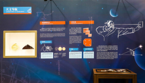
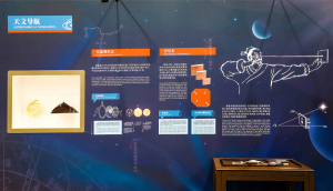
古代在大海上航行,导航主要是靠天上的星星。在这里,您可以看到十几块木板垒起来的,类似金字塔的东西,这个就是根据古代文献复原出来的“古代GPS”——牵星板。这个牵星板,它从下往上是十二块小木板堆起来的,正中间有一条线。牵星板具体的使用方法还不确定,但据一些专家推测,它大概是这么使用的。
Ancient celestial navigation primarily relied on stars. This pyramid-like pile of a dozen wooden boards is an ancient GPS reconstructed based on ancient text–Qianxing Boards. Twelve small wooden boards are piled up from the bottom up with a cord in the middle. Although its specific usage is still uncertain, some experts have speculated on its usage.
使用的时候,取下其中一块木板。一只手竖着拿木板,一只手把木板中间的绳子拉紧,拉到眼睛旁边。然后把木板的下边缘对准海平面,上边缘对准要测量的星星。如果木板上面够不到星星,就换更大的木板。如果看不见星星了,就换更小的木板。以北极星为例,就是船只位置越靠北,北极星看起来越高,仰角就越大,就要用更大的木板;船只位置越靠南,北极星越低,仰角越小,就要用更小的木板。这样,通过木板的大小,来判断北极星的高度,从而推测船只所在的纬度。
Pull out one of the boards and hold the board vertically with one hand. Tighten the cord in the middle towards your eyes with your other hand, and then align the board’s lower edge with the sea level and the upper edge with the star to be measured. If the upper edge fails to align with the star, replace it with a larger or smaller board until successful. Taking Polaris as an example, the further north the ship is, the higher the Polaris appears and the greater the elevation is, which means larger boards are needed and vice versa. Thus, based on the wooden board size, we are able to determine Polaris’ height and estimate the ship’s latitude.
比如,假设我们从泉州出发,往正南方向航行。在泉州的时候,我们观察到北极星的高度,正好对应的是一块比较大的牵星板,往南航行了一段时间以后,发现北极星的高度对应的牵星板变小了,这就说明北极星的仰角也就相应的变小了。假设仰角是变小了5度,那根据我们今天掌握的知识,就可以推测出这艘船大概就向正南方向航行了500多公里。
Suppose we depart from Quanzhou and sail due south and the Polaris’ height that we observed at Quanzhou corresponds to a relatively large Qianxing Board. After sailing southward for a period of time, we would find that the Qianxing Board corresponding to the Polaris’ height becomes smaller, indicating that its elevation has also become smaller. Assuming that the elevation is reduced by 5 degrees, then we can infer that the ship has sailed due south for over 500 km based on what we have learned today.
在展板左边,您还能看到早在古希腊时期就已经出现的西方GPS——星盘。这个星盘的主体是一个四周有刻度的铜盘,在盘的正面,画着星图和地平坐标网,在它的背面,装了有一可绕中心旋转的管子,当我们需要观测的时候,只需要将铜盘竖着挂起来,用管子对准太阳,或者恒星,就可从盘边的刻度上得到它们的高度。这种工具,比起牵星板,更加精确。
On the left side of the display panel is an astrolabe, a navigational tool (GPS) that first appeared in ancient Greece. Its main body is a copper disk with the edges marked in degrees. From the front, it presents a star chart and a horizontal coordinate network and from the back, it’s installed with a tube that can revolve around its center. To use it, we simply hang the copper disk upright, point the tube at the sun or star, and get the height from the degrees on the edge. The astrolabe is more accurate compared to the Qianxing Boards.
接下来,我们去右边看看大海上其他的导航工具。
Next, let’s go to the right to see other navigation instruments.


 京公网安备11010502039775号


