Last week, Mackle heard that a new theme park was finished near his home. He was itching to go, but he had to go to school from Monday to Friday. Finally, the weekend had come. Mackle couldn't wait to go there. At this moment, Dad stopped him to hand him a mobile phone and said, "Mackle, be careful! To reassure us, I have to give you my phone. In this way, I can contact with you. And you can use it to find the way. Do you remember how to locate where you are? I told you before."
Mackle nodded and said, "Yes, I know! I can not only locate myself, but also know why the phone can do it! I will tell you after I come back!"
Dad smiled and saw Mackle off.
After a few hours, Mackle came back. Obviously, he didn't run out of energy after playing in the park. When he got home, he came to Dad and asked him to hear him out why the phone could locate his position. Although Dad was reluctant, he still said, "Okay, okay, Mackle, you are my teacher again."
Mackle said excitedly, "The common positioning system used in mobile phones is GPS. Do you know that?"
Dad answered, "Yes, of course."
Mackle went on, "GPS is the abbreviation of Global Positioning System. There are a group of "satellites" around 20,000 kilometers above the earth. They run around the earth and transmit signals to the ground the whole time. These signals are used to determine your location when they are received by your device."
Dad inquired, "Can you give me more details? How to locate the position? What’s the 'secret' in these signals?"
Mackle answered, "The signal has no secret! It just uses a simple mathematical principle to complete the positioning work. This method is called the trilateration positioning method. The main body of the GPS system consists of 24 satellites. This system guarantees there are 4 satellites connecting to your device directly. This is very important. It means that this system can receive information of three different position coordinates at any time and at any position. First, your device should be installed with a GPS receiver. The satellite will send to it some important navigation information, such as time and location. This will be enough for your device to calculate your position on the earth. By multiplying the time by the speed of light, you can figure out the distance between you and each satellite. Draw a spherical surface around each satellite with the distance as its radius. Two satellites can draw two of that, and so on, we can get four spherical surfaces. These four spherical surfaces will have a unique intersection. This is your location."
"The statement that spherical surfaces intersect with each other seems to be very complicated," Dad seemed to be a little confused and nodded his head.
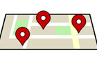
“If you don't understand how the spherical surfaces intersect with each other, just think about how we locate the position on a plane. If you want to locate the position of a park, you should know the distance between the park and your home as well as that between the park and your school. Therefore, you can draw two circles with the home and the school as the center respectively, but these two circles will have two intersections. What to do in the next step? Find another place. You can ask Mom how far it is between the supermarket you often go and the park. Then draw a circle with the supermarket as its center. The intersection of the three circles is the location of the park. Although the principle is simple, complicated calculations are needed to get the precise position in practice.
"Mackle knows more than I do!" Dad held his hand on his face and pretended to cry. In fact, he was so happy.
"I'm not finished. There is more information I want to tell you. At present, there are four mainstream positioning systems in the world: Global Positioning System (GPS) from the United States, Global Navigation Satellite System (GLONASS) from Russian, the Galileo satellite navigation system (GALILEO) from European and BeiDou Navigation Satellite System (BDS) from China, among which the Global Positioning System (GPS) from the United States is the most widely used in the world," Mackle stopped.
Dad said, "Mackle, you are so smart. I believe you will make China proud."
Author: Zhu Yawen